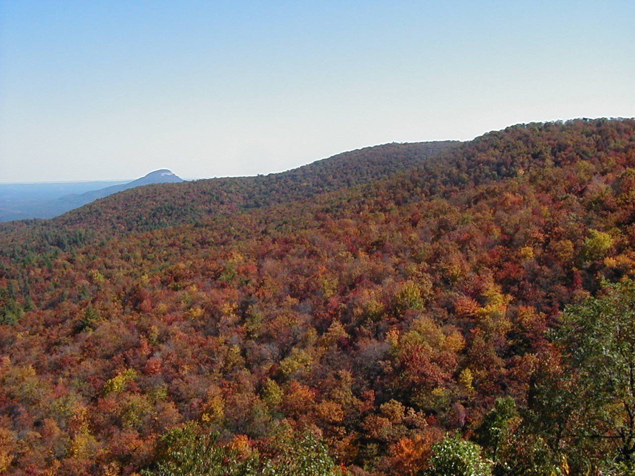
Fall color on forested mountain ridges seen from the Raven Cliffs overlook in the Georgia mountains
Blue Ridge, Georgia

Top 7 Hikes Near Blue Ridge

Waterfalls, ridge-top views, and a swinging bridge — the best trails within about 70 minutes of the cabin, plus one trailhead you can walk to.

Hike all day, soak all night. The hot tub is waiting. See open dates. Click here →

The top seven hikes near Blue Ridge, GA are Benton MacKaye Trail Segment 8a-8d from Bushy Head Gap, Long Creek Falls via the Appalachian Trail, Fall Branch Falls on the Benton MacKaye Trail, the Toccoa River Swinging Bridge, Rocky Mountain via Stanley Gap Trail, the Trahlyta Lake Trail at Vogel State Park, and Long Branch Loop in the Aska Trail System. They range from a 0.5-mile round-trip waterfall walk to a 6 to 10 mile day hike, and every trailhead is within about 70 minutes of the cabin.

Picked by the hosts of Southern Serenity Cabin, a cabin rental in Cherry Log, Georgia.

Last verified

The North Georgia mountains put some of the Southeast's best hiking right outside your door. From short waterfall walks that work for any age to full-day ridge climbs with 360-degree views, the trails around Blue Ridge cover every ability level. Most are free, all are worth it, and none require more than a 35-minute drive from downtown.

Forested ridgeline trail on the Benton MacKaye Trail Section 8 near Blue Ridge, Georgia
1

Benton MacKaye Trail Segment 8a-8d: Bushy Head Gap to Fowler Mountain

Intermediate 6.6 mi point to point 2 min from the cabin (0.6 mi)

Walk from the cabin: this trailhead is 0.6 miles from Southern Serenity, about a 15-minute walk.

The closest trail to the cabin starts at Bushy Head Gap, just 0.6 miles away, so you can walk to the trailhead. This point-to-point segment of the Benton MacKaye Trail (8a to 8d) climbs a ridgeline to Fowler Mountain, passing Bear Den Mountain, which crosses a previously burned area, and then Hudson, McKenny, and Hatley Gaps. The views are wide, especially in winter. The trail gains 1,939 feet overall with a high point of 3,386 feet, and camping is available at several of the gaps. There is no vehicle access at Fowler Mountain, so plan an out-and-back day hike unless you arrange a pickup.

Pro Tip October and November bring the best seasonal ridge views once the leaves drop. Bring a paper map — cell signal is nonexistent through most of this section.
Long Creek Falls on the Appalachian Trail near Blue Ridge, Georgia
2

Long Creek Falls via Appalachian Trail

Moderate 1.9 mi out-and-back 1 hr 7 min from the cabin

This trail follows the Appalachian and Benton MacKaye Trails through the lush Three Forks valley along Long Creek — a clear trout stream hemmed in by rhododendron and towering hemlocks. The payoff is Long Creek Falls, a two-tiered 50-foot cascade dropping into a calm blue pool. It's one of the most scenic waterfall destinations on the southern AT, with a gentle elevation gain that makes it accessible without feeling too easy. Access is via a 5.3-mile drive on gravel Forest Road 58 to the Three Forks trailhead; high-clearance vehicles recommended.

Pro Tip Spring after a rain turns the falls into a roaring showcase. Arrive early on weekends — the small parking area fills by mid-morning.
Fall Branch Falls double cascade on the Benton MacKaye Trail near Blue Ridge, Georgia
3

Fall Branch Falls on the Benton MacKaye Trail

Easy – Moderate 0.5 mi round-trip 32 min from the cabin

A short half-mile round-trip on the Benton MacKaye Trail leads to a gorgeous double-cascade waterfall framed by gnarly rhododendron branches and moss-covered boulders. The trail climbs steadily beside Fall Branch Creek, catching glimpses of smaller cascades before reaching a wooden observation deck with a face-on view of the 30-foot falls. It's one of the most family-friendly waterfall hikes near Blue Ridge, and the free USFS trailhead off gravel Stanley Creek Road means zero cost to visit.

Pro Tip Combine this with the Toccoa River Swinging Bridge hike — they're a short drive apart and together make a full half-day outdoor loop.

Top 5 Airbnbs in Blue Ridge

Looking for a cabin base camp for all of this? Southern Serenity is ready for your crew.

Book Now
Toccoa River Swinging Bridge suspension bridge on the Benton MacKaye Trail
4

Toccoa River Swinging Bridge

Easy 0.8 mi out-and-back 1 hr 6 min from the cabin

A flat 0.8-mile walk on the Benton MacKaye Trail delivers you to the longest swinging suspension bridge east of the Mississippi — a 270-foot span that bounces with every step over the wide-flowing Toccoa River. Built in 1977, it's a must for families and kids. Cross the bridge and explore a small waterfall tucked in a hemlock grove on the opposite bank. An optional 2-mile extension climbs a forested ridge for anyone wanting more solitude after the crowds turn back at the bridge.

Pro Tip Check Forest Service Road 816 conditions before heading out — the gravel road can be rough and has had seasonal closures. Call the Toccoa Ranger District at (706) 632-3031 for current status.
Rocky Mountain summit view via Stanley Gap Trail in the Chattahoochee National Forest near Blue Ridge, Georgia
5

Rocky Mountain via Stanley Gap Trail

Moderate – Challenging 5.9 mi out-and-back 28 min from the cabin

This 5.9-mile out-and-back (or 9.7-mile point-to-point with a shuttle) climbs through the Chattahoochee National Forest off Aska Road, ascending Davenport Mountain and briefly joining the Benton MacKaye Trail before summiting Rocky Mountain. The views from the ridgeline are among the best long-range panoramas in the Blue Ridge area — rolling forest in every direction. Rated moderate to challenging with 2,290 feet of elevation gain. The closest full summit hike to town that actually delivers on the views.

Pro Tip For the point-to-point, drop a car at Deep Gap first then drive to Stanley Gap. Wildflowers along the lower trail are outstanding in April and May.
Trahlyta Falls at Vogel State Park, Georgia
6

Trahlyta Lake Trail & Falls at Vogel State Park

Easy 1 mi loop 1 hr from the cabin

This easy 1-mile loop circles Lake Trahlyta in Vogel State Park, crossing a 1935 earthen dam built by the Civilian Conservation Corps. A short spur leads to an observation deck below the spillway, and the view from the bridge looks toward Blood and Slaughter Mountains. The path is part natural surface and part paved, takes about an hour, and suits kids and a relaxed pace.

Pro Tip The spur down to the falls platform is steep, so stick to the lake loop with strollers or small kids. A parking fee applies; call the park at (706) 745-2628 to confirm the amount.
Blue Ridge, Georgia
7

Long Branch Loop (Aska Trails)

Easy 2.1 mi loop 31 min from the cabin

Long Branch Loop starts at the Shady Falls trailhead in the Aska Trail System, about 6 miles south of Blue Ridge on Aska Road. The loop runs roughly 2.1 miles through national forest on lime-green-blazed trails and connects to the Benton MacKaye Trail. The Forest Service lists the trails as free and open year-round, which makes this an easy add-on for a free afternoon.

Pro Tip Mountain bikers use the same trails, so keep kids and dogs close at blind turns. There is no water on the trail, so bring your own.

Questions about hikes near Blue Ridge

Which hike near Blue Ridge is best for kids?

Fall Branch Falls is a 0.5-mile round-trip on the Benton MacKaye Trail that ends at a wooden observation deck facing the 30-foot falls. The Toccoa River Swinging Bridge is a flat 0.8-mile walk to a 270-foot suspension bridge.

Do I need a high-clearance vehicle to reach these trailheads?

High-clearance vehicles are recommended for Long Creek Falls, which is reached by a 5.3-mile drive on gravel Forest Road 58. Forest Service Road 816 to the Swinging Bridge can be rough, so call the Toccoa Ranger District at (706) 632-3031 for its current status.

Which Blue Ridge hike has the best views?

Rocky Mountain via Stanley Gap Trail is a 5.9-mile out-and-back with 2,290 feet of elevation gain and long-range ridgeline views. It is about 28 minutes from the cabin, the closest full summit hike.

How long is the Toccoa River Swinging Bridge hike?

It is a flat 0.8-mile out-and-back on the Benton MacKaye Trail to a 270-foot suspension bridge built in 1977. An optional 2-mile extension climbs a forested ridge on the far side.

Is there cell service on Benton MacKaye Trail Segment 8a-8d?

No. Cell signal is nonexistent through most of the section that starts at Bushy Head Gap, so bring a paper map. October and November bring the best seasonal ridge views.